LOMA BONITA SEMARV Scenery
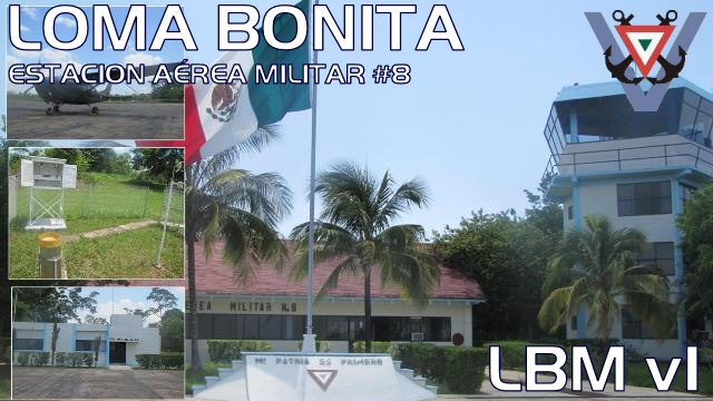
Estación Aérea Militar No. 8, Loma Bonita, Oaxaca, México.
ICAO: MX67 - IATA: LBM.
Scenery Info.
The airport its located near of the town of Loma Bonita in Oaxaca state, in Mexico.
The Military Air Station No. 8, is operated by the Mexican Air Force and is used to give air support to the Regiment of the Mexican Army based in this place.
Here we locate, the military meteorological station no. 29.
Información de Escenario.
Este aeropuerto esta localizado cerca del pueblo de Loma Bonita, Oaxaca, en México.
La estación aérea militar no. 8, es operada por la Fuerza Aérea Mexicana y es usada para dar soporte aéreo al 6/o Regimiento de Caballería Motorizado del Ejercito Mexicano, basado en este mismo lugar.
Aquí también se encuenta la sede de la estación metereológica militar no. 29.
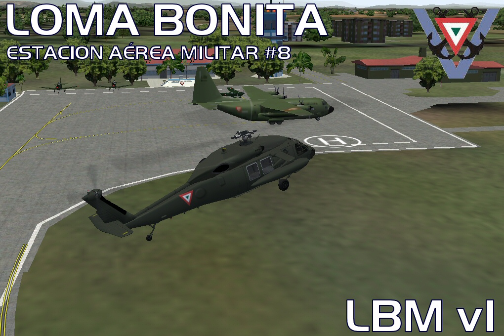
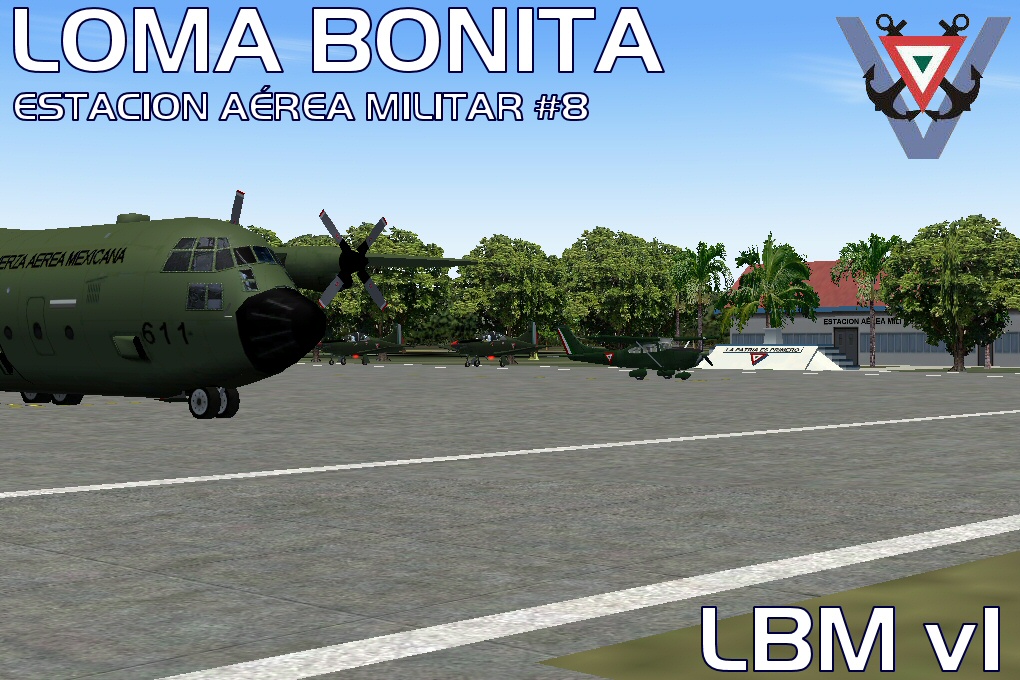
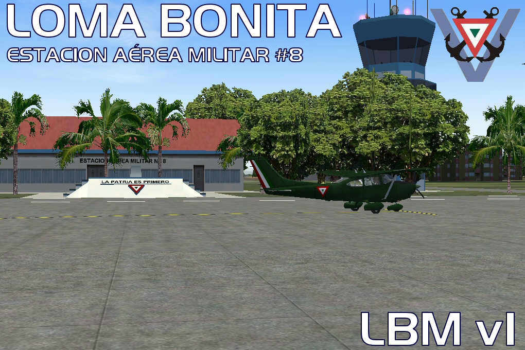
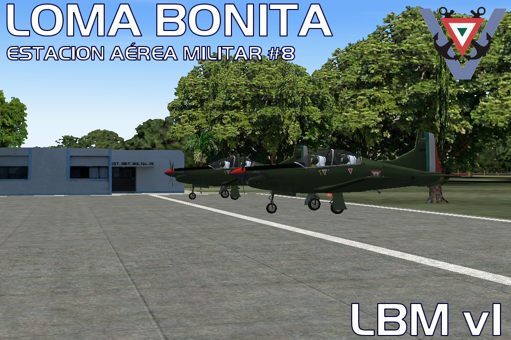
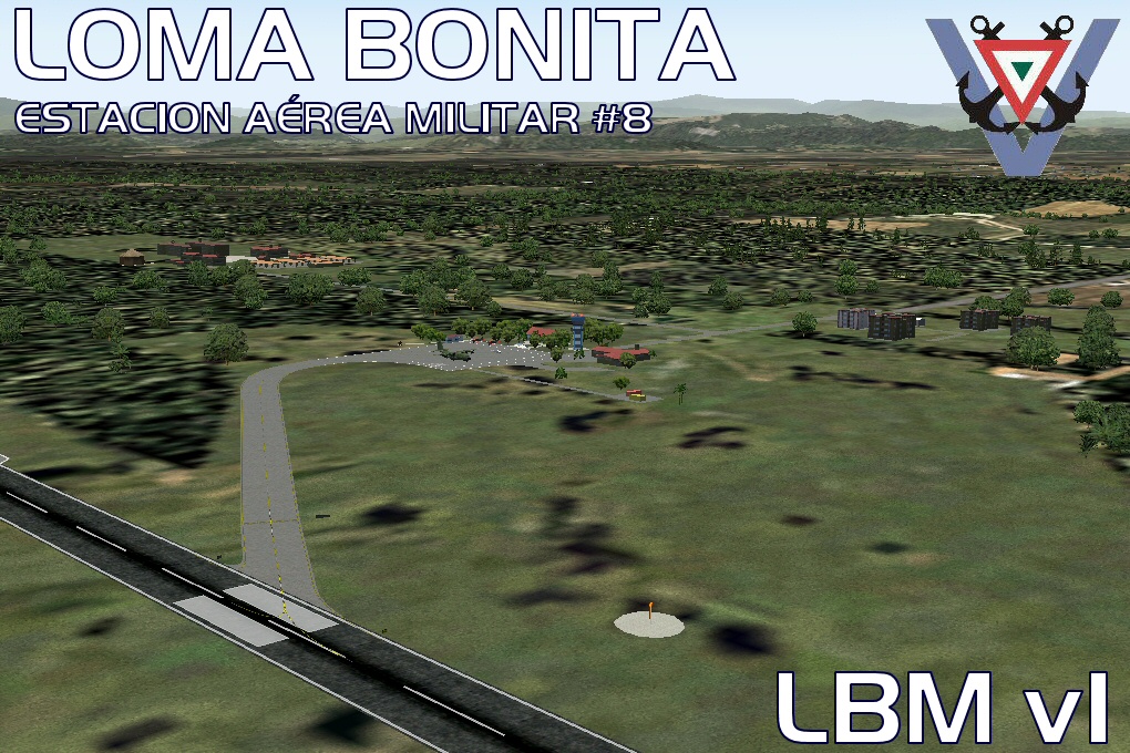
Imagenes del Escenario / Images of the scenery.
The airport its located near of the town of Loma Bonita in Oaxaca state, in Mexico.
The Military Air Station No. 8, is operated by the Mexican Air Force and is used to give air support to the Regiment of the Mexican Army based in this place.
Here we locate, the military meteorological station no. 29.
Información de Escenario.
Este aeropuerto esta localizado cerca del pueblo de Loma Bonita, Oaxaca, en México.
La estación aérea militar no. 8, es operada por la Fuerza Aérea Mexicana y es usada para dar soporte aéreo al 6/o Regimiento de Caballería Motorizado del Ejercito Mexicano, basado en este mismo lugar.
Aquí también se encuenta la sede de la estación metereológica militar no. 29.
Imagenes del Escenario / Images of the scenery.

Scenery History / Historia del escenario:
VERSION 1
Gmax Objects, Afcad and Landclass.
Also contain Agualeguas old (MM1L), La Gloria (TKT) and Rancho la Joya (RHD) airstrips.
All airports and airstrips are based in real positions using satellite imagery to establish a standardization for IVAO, VATSIM of any Flight simulation network.
Objects:
MX67:
- Control Tower.
- Air Force buildings.
- Mexican Army buildings.
- Trees inside the airport.
Landclass.
Airport Skirt of Loma Bonita.
Neighbor areas.
Charts:
No charts.
This is a SEMARV Scenery Design.
semarv.webs.com/
by Omar Eduardo Herrera
[email protected]
[email protected]
semarv.webs.com/
by Omar Eduardo Herrera
[email protected]
[email protected]
